Traffic cameras are a common sight for drivers in California, and they can be found in many locations across the state. These cameras are used to monitor traffic flow and manage congestion on highways, freeways, parkways, and major roads or intersections. While they may resemble red-light or speed cameras, they do not issue tickets or fines. California's traffic cameras are located in various cities, including Los Angeles, San Francisco, San Diego, and many others. Live traffic camera systems are also available to help drivers plan better routes and improve road safety.
| Characteristics | Values |
|---|---|
| Purpose | Monitoring traffic flow, managing traffic, and improving road safety |
| Location | Highways, freeways, parkways, major roads, intersections |
| Functionality | Some cameras capture videos, while others capture still images |
| Accessibility | Live traffic feed is open to the public |
| Use Cases | Avoiding freeway congestion, road closures, and extreme weather or road conditions |
| Data Privacy | Data is neither retained nor archived |
What You'll Learn
![]()
Traffic cameras in Los Angeles
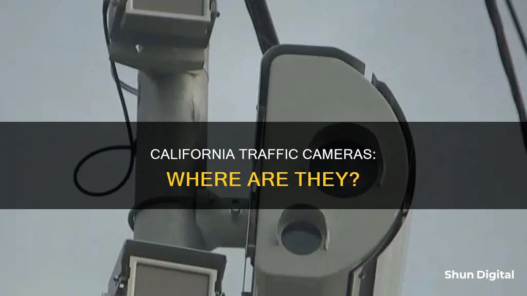
Traffic cameras are used to monitor traffic flow and are typically located on top of traffic lights. Red-light cameras, on the other hand, are located on the side or corner of an intersection and can issue photo-enforced tickets.
In Los Angeles, there are several traffic cameras located across the city. A non-exhaustive list of locations includes:
- I-110 @ I-10 (CHP Tower)
- I-10: (130) West of I-5
- W10 - West of RTE 5: PM 18.5
- I-405: (359) La Tijera
- I-710: (284) North of I-5
- I-710: (282) Washington Blvd
In addition to these traffic cameras, Los Angeles is also set to implement speed cameras in certain areas of the city. A bill that was signed into law by Governor Gavin Newsom in 2023 authorized a pilot program for speed cameras in Los Angeles, along with five other California cities. These speed cameras will be installed in school zones and areas with a history of traffic violence and street racing. The program aims to reduce traffic deaths and injuries by targeting speeding drivers.
Unlocking Camera Raw: Load Your Presets Like a Pro
You may want to see also
![]()
Traffic cameras on California highways
California's highway system is monitored by a network of traffic cameras that provide real-time information on road and traffic conditions. These cameras are located on highways, freeways, and major roads or intersections across the state. While the exact locations of these cameras are not always disclosed, several resources are available to help drivers locate and access them.
One such resource is the Caltrans Commercial Wholesale Web Portal, which provides access to Caltrans cameras, lane/road closures, chain control information, and changeable message signs. The data from this portal is utilised by various apps and websites, which in turn provide users with a visual representation of traffic conditions. One such app is the "California Traffic Cameras" app available on Google Play. This app allows users to browse Caltrans cameras and access a Google Map with the current traffic layer, making it easier for drivers to plan their routes and avoid congestion.
In addition to apps, there are websites dedicated to providing live traffic camera feeds and maps, such as PhotoEnforced.com and GetDismissed.com. PhotoEnforced.com is an open database of red-light camera and speed camera locations, fines, and related information. It is continuously updated by users and provides a comprehensive view of traffic enforcement locations across California. GetDismissed.com, on the other hand, offers a live California traffic camera map tool that helps drivers plan better routes, create easier commutes, and improve road safety. This tool allows users to access live video feeds and images from traffic cameras located on highways, freeways, parkways, and major roads or intersections.
It is worth noting that the live traffic camera feeds and images provided by these sources are not used for law enforcement purposes but are strictly for traffic management and the improvement of road safety. By utilising these resources, drivers in California can make more informed decisions about their routes, avoid congested areas, and potentially save time and money by circumventing unsafe road conditions.
Selecting Camera Landscapes: Camera Raw Tips
You may want to see also
![]()
Traffic cameras on California freeways
California's freeway system is monitored by an extensive network of traffic cameras, which are located on highways, freeways, parkways, and at major intersections. These cameras serve a variety of purposes, including traffic management, enforcement of traffic laws, and ensuring road safety.
The Caltrans Live Traffic Cameras system provides live video and still images from numerous locations across California's freeway system. The Caltrans Commercial Wholesale Web Portal offers an unofficial app that allows users to browse Caltrans cameras and access lane/road closures, chain control information, and changeable message signs. The app also provides a Google Map with the current traffic layer, making it easier for drivers to plan their routes and avoid congestion.
The live California traffic camera system also covers highways, freeways, parkways, and major roads and intersections. This system is designed to help drivers plan better routes, create easier commutes, and improve road safety. The map features red and green camera icons, with red indicating a camera with a video feed and green indicating a camera that captures still images.
It is important to note that traffic cameras should not be confused with red light cameras. Traffic cameras are typically located on top of traffic lights and are used for monitoring traffic flow. On the other hand, red light cameras are usually positioned at the side or corner of an intersection and are used for issuing tickets for red-light violations.
By utilizing these traffic camera systems, drivers in California can make informed decisions about their routes, avoid congested areas, and ultimately improve the efficiency of their travels on the state's freeways.
Steady Shots: Stabilizing Your Camera in a Moving Car
You may want to see also
![]()
Traffic cameras in California cities
Traffic cameras are located in many cities across California. These cameras are used to monitor traffic flow and manage congestion. They are typically placed on traffic poles or on top of traffic lights.
In Los Angeles, for example, traffic cameras can be found at various locations, including the I-110 near the I-10 (CHP Tower), the S101 near First St, the I-405 near La Tijera, and the I-710 near 3rd St, among others.
The Caltrans Live Traffic Cameras provide another network of cameras that cover many routes across California. These cameras are located along routes that run from south to north and from west to east. For instance, there are Caltrans cameras on the I-5, SR-1, SR-2, SR-4, and I-8, to name a few.
Additionally, there are traffic cameras in several other cities throughout the state. These include major cities such as San Diego, San Francisco, Oakland, and Sacramento, as well as smaller cities like Napa, Chico, and Redding.
It is worth noting that there are also red-light cameras and speed cameras in California, which are different from traffic cameras and are used for issuing tickets. These are typically located at intersections or on the side of the road.
Traffic Camera Tickets: How Long Until They Arrive in Florida?
You may want to see also
![]()
Live traffic cameras in California
California's Department of Transportation, Caltrans, operates a network of live traffic cameras across the state. These cameras are mounted on traffic poles or placed on top of traffic lights to monitor traffic flow and help manage road conditions. While Caltrans does not retain or archive footage or images from these cameras, they are accessible to the public via the Caltrans Commercial Wholesale Web Portal.
The Caltrans website provides a table with links to individual live traffic cameras. These cameras are organised by route, with routes running south to north listed from the southernmost camera location, and those running west to east listed from the westernmost camera location. This table includes camera locations on various state routes, interstates, and highways across California.
For example, State Route 1 (SR-1) has cameras at the following locations: Hawthorne Blvd, Aviation Blvd, Manhattan Beach Blvd, Foothill Blvd, South of SR-46 West, Hearst Castle, Carmel Valley Road, North of Del Monte Blvd, East of Munras Ave, Lightfighter Drive, Imjin Parkway, Moss Landing Rd, SR-129 Northbound Exit, SR-129 Southbound Exit, Green Valley Rd, SR-152 Southbound Exit, Buena Vista Dr, North of Buena Vista Dr, South of Mar Monte Ave, North of Mar Monte Ave, Larkin Valley Rd, Rio Del Mar Blvd, State Park Drive, and many more.
In addition to the Caltrans website, there are also third-party apps that provide access to Caltrans traffic cameras. However, reviews of these apps indicate that they may only offer still photos from the cameras rather than live video streams.
The Evolution of Cameras: A Historical Perspective
You may want to see also
Frequently asked questions
Traffic cameras are located on highways, freeways, parkways, roads, and intersections across California. They are used to monitor and manage traffic flow and are not used by law enforcement.
You can find the locations of traffic cameras in California by using a live traffic camera map tool or by downloading an app such as California Traffic Cameras. These tools can help you plan better routes and avoid freeway congestion, road closures, and extreme weather conditions.
Yes, there are differences between traffic cameras and red-light cameras in California. Traffic cameras are typically located on top of traffic lights and are used to monitor traffic flow. They do not issue tickets or fines. Red-light cameras, on the other hand, are located on the side or corner of intersections and are used for photo enforcement of traffic violations.