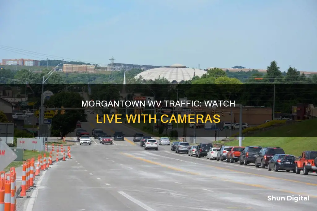
If you're looking to access traffic cameras in Morgantown, WV, there are several options available. The West Virginia Department of Transportation has created a tool called WV511, which provides real-time traffic updates, road conditions, and access to traffic cameras across the state. You can access this information by calling 511 toll-free, visiting WV511.org, using the WV 511 Drive Safe mobile app, or checking Twitter (@WV511). Additionally, websites like WeatherBug and LocalConditions.com offer live traffic cameras and traffic flow maps specific to Morgantown, WV, providing visual insights into the current road conditions. These tools can be valuable for planning your route and staying informed about any potential travel delays.
| Characteristics | Values |
|---|---|
| Tool | WV511 |
| Tool Provider | West Virginia Department of Transportation |
| Information Shown | Traffic, planned events, road conditions, signs, cameras, and National Weather Service reports |
| Updates | Real-time |
| How to Receive Updates | Calling 511 toll-free, visiting WV511.org, downloading the free WV 511 Drive Safe mobile app for Android and iPhone, or following @WV511 on Twitter |
| Traffic Flow Lines | Red/White dashed lines = Closed Road, Grey/White dashed lines = Road Work, Red lines = Heavy traffic flow, Yellow/Orange lines = Medium flow, Green = normal traffic |
| Traffic Incidents | Each image represents a traffic event or incident such as road construction, closure (red circle with a white dash), or accident |
| Map Zoom | Zoom in to see localized data |
| Map Refresh Rate | Traffic flow updated at load time, upon movement outside the initial map view, or upon refresh; incident markers checked for updates approximately every 5-10 minutes |
| Morgantown, WV Traffic Cameras | I-68 and I-79 Interchange, I-68 and US 119 Interchange, I-79 and I-68 Interchange, I-79 and MM 153, US-119 and Mileground Roundabout, US-19 and University Ave at Westover Bridge, Van Voorhis and Elmer Prince, WV-7 and CRT 19 and 24, WV-705 and Chestnut Ridge at Pineview, WV-705 and Patteson Drive, WV-705 and Stewartstown |
What You'll Learn
- WV511: a tool by the West Virginia Department of Transportation
- Real-time traffic updates: call 511, visit WV511.org, or use the mobile app
- Traffic flow lines: colours indicate road status
- Traffic incidents: red circle with a white dash indicates road construction, closure, or accident
- Morgantown, WV traffic cameras: I-79, I-70, I-68, and more

WV511: a tool by the West Virginia Department of Transportation
WV511 is a tool by the West Virginia Department of Transportation that provides real-time traffic updates and road conditions for the state of West Virginia, including Morgantown. It offers a comprehensive view of traffic, planned events, road conditions, signs, cameras, and National Weather Service reports.
Motorists can access WV511 through various platforms to get up-to-date information before embarking on their journey. One option is to call 511 toll-free, which provides 24-hour access to real-time traffic updates. Additionally, visiting WV511.org offers a wealth of information on traffic conditions, roadwork, and potential delays. The WV 511 Drive Safe mobile app, available for both Android and iPhone users, brings convenience to those who prefer receiving updates on their mobile devices. This app likely provides easy-to-read maps and alerts, making it a go-to choice for many drivers.
For those who are active on Twitter, following @WV511 will ensure they receive the latest traffic tweets, which can be especially helpful for last-minute checks before leaving. Additionally, WV511 offers a website account feature that allows users to manage notification subscriptions, save form progress, and more. This personalised account feature ensures that users receive tailored updates and can efficiently access the information they need.
The West Virginia Department of Transportation encourages all drivers to "Know Before You Go" by utilising the WV511 system. This proactive approach can help motorists make informed decisions, avoid potential traffic congestion or road closures, and ultimately save time and have a smoother journey.
Georgia's Camera Ticket Policy: What You Need to Know
You may want to see also

Real-time traffic updates: call 511, visit WV511.org, or use the mobile app
WV511 is a tool created by the West Virginia Department of Transportation that provides real-time traffic updates. Motorists can access this information 24 hours a day by calling 511 (toll-free), visiting WV511.org, or using the free WV 511 Drive Safe mobile app, available for both Android and iPhone.
The WV 511 system offers a comprehensive overview of traffic conditions, planned events, roadwork, and weather reports across West Virginia, including Morgantown. It is recommended that drivers check this information before starting their journey to make informed decisions and navigate potential delays effectively.
The WV511 website provides a detailed Morgantown traffic map, which uses color-coded lines to indicate traffic flow and road closures. This map is interactive, allowing users to zoom in for more localized data and click on incident icons to obtain specific information about road construction, closures, or accidents. The map is updated at load time and upon movement or refresh, ensuring users have access to the most current information available.
In addition to the visual map, the WV 511 system also offers alerting services and traffic incident reports, providing timely notifications about potential delays or road closures. This comprehensive suite of tools empowers motorists with the information they need to navigate Morgantown's road network efficiently and safely.
Beeping Night Owl Cameras: What Does It Mean?
You may want to see also

Traffic flow lines: colours indicate road status
To watch traffic cameras in Morgantown, WV, you can use the WV511 tool created by the West Virginia Department of Transportation. This tool provides real-time traffic updates, road conditions, and access to cameras across the state. You can access WV511 by calling 511 toll-free, visiting WV511.org, using the WV 511 Drive Safe mobile app, or following @WV511 on Twitter.
Now, here is some information about traffic flow lines and their colours:
Traffic flow lines, also known as pavement markings, are used to convey important information to drivers and help manage the flow of traffic. The colours of these lines indicate the status of the road and provide instructions on driving directions, passing rules, and lane usage.
Yellow Lines:
Yellow lines are typically used to separate traffic flowing in opposite directions. Drivers should generally stay to the right of yellow lines. Here are some common types of yellow lines and their meanings:
- Solid Yellow Line: Indicates that passing is prohibited. It often marks the left edge of a divided highway or one-way street.
- Dashed Yellow Line: Indicates that passing is allowed. It marks a two-direction passing zone where vehicles can carefully overtake other vehicles when the way ahead is clear.
- Double Yellow Lines: Indicate a no-passing zone. Traffic from either direction is not allowed to pass in this area.
White Lines:
White lines are used to separate lanes of traffic moving in the same direction. Here are the common types of white lines and their meanings:
- Single White Line: Indicates that lane changes are discouraged but not prohibited.
- Dashed White Line: Indicates that lane changes are allowed and drivers can safely change lanes when clear.
- Double White Line: Indicates that lane changes are prohibited. Drivers should not cross these lines to change lanes.
In addition to yellow and white lines, you may also encounter other pavement markings with specific meanings:
- Sharrows: Shared lane markings that indicate a lane can be used by both motorists and bicyclists.
- HOV Lanes: Lanes reserved for high-occupancy vehicles, marked with a white diamond symbol.
- Stop or Limit Lines: White lines painted across the travel lane at intersections, indicating where vehicles must stop when directed by signs or signals.
Zumimall Camera Charging Time: How Long Should You Wait?
You may want to see also

Traffic incidents: red circle with a white dash indicates road construction, closure, or accident
To watch traffic cameras in Morgantown, WV, you can utilise the WV511 tool, created by the West Virginia Department of Transportation. This platform provides real-time information on traffic, road conditions, signs, cameras, and National Weather Service reports across the state. To access this tool, you can call 511 toll-free, visit WV511.org, use the WV 511 Drive Safe mobile app, or follow @WV511 on Twitter.
Now, let's discuss the specific symbol you mentioned: a red circle with a white dash. This symbol typically signifies road construction, closure, or an accident. When you encounter this symbol on traffic maps or navigation systems, it serves as a visual indicator of a potential traffic disruption. The red circle with a white dash is a widely recognised symbol intended to promptly capture your attention and convey the presence of an unexpected road event or condition ahead.
This symbol is strategically designed to be easily noticeable, even from a distance or at a glance. The use of the colour red, in particular, signifies caution and alerts motorists to be vigilant and prepared for possible delays or detours. The white dash in the centre of the circle adds to the visual distinctiveness of the symbol, ensuring that it stands out against the map or navigation interface.
When you see this symbol, it is advisable to pay closer attention to the details provided by your navigation system or traffic app. They may offer additional information about the specific incident, such as the cause of the disruption, expected delays, or suggested alternative routes to help you navigate around the affected area efficiently.
By incorporating this symbol into traffic mapping systems, motorists can quickly identify areas where their journeys may be impacted and make informed decisions to ensure safer and more efficient travel. This symbol is just one example of the many visual representations used in traffic mapping to enhance your awareness and decision-making while on the road.
Traffic Cameras in Massachusetts: Are They Watching?
You may want to see also

Morgantown, WV traffic cameras: I-79, I-70, I-68, and more
If you're looking to keep an eye on traffic in Morgantown, WV, there are several tools and resources available to help you access live traffic camera feeds and stay informed about road conditions. Here's a guide to navigating traffic cameras on I-79, I-70, I-68, and other key routes in and around Morgantown, WV:
WV511:
WV511 is an official tool created by the West Virginia Department of Transportation. It provides real-time traffic updates, road conditions, planned events, and access to traffic cameras and National Weather Service reports across the state. This service covers all major highways and roads in Morgantown, including I-79, I-70, and I-68.
To access WV511, you can:
- Call 511 toll-free, available 24 hours a day.
- Visit the WV511.org website.
- Download the free WV 511 Drive Safe mobile app, available for Android and iPhone.
- Follow @WV511 on Twitter for updates.
WeatherBug:
WeatherBug is a private service that provides live traffic camera feeds and local road condition updates for Morgantown, WV. While not all cameras are directly on the interstate highways, they can provide valuable insights into traffic flow and conditions on and around I-79, I-70, and I-68. Here are some key camera locations listed on WeatherBug relevant to these highways:
- I-79 @ EXIT 1 (MOUNT MORRIS) and EXIT 14 (PA 21 MASONTOWN/WAYNESBURG).
- I-70 @ EXIT 37 (PA TURNPIKE 43) and EXIT 41 (PA 906 BELLE VERNON/MONESSEN).
- I-68 @ US-219 (Keysers Ridge).
- I-70 @ EXIT 24 (I-79 SOUTH MORGANTOWN).
- I-70 @ MM 0.2 (OHIO LINE) and MM 57.4 (I-76/PA 66 BUSINESS JUNCTION).
Additional Resources:
In addition to the above resources, you can also refer to the West Virginia Department of Transportation's website and social media channels for general travel and road condition updates. They may also provide alerts and notifications about specific incidents or road closures.
By utilising these tools and resources, you can effectively monitor traffic conditions on I-79, I-70, I-68, and other routes in and around Morgantown, WV, helping you plan your journeys and stay informed about any potential delays or incidents.
Understanding Camera Battery Labels: S and T Explained
You may want to see also
Frequently asked questions
You can watch traffic cameras in Morgantown, West Virginia, by visiting WV511.org or downloading the free WV 511 Drive Safe mobile app for Android and iPhone.
Motorists can receive real-time traffic updates 24 hours a day by calling 511 toll-free or following @WV511 on Twitter.
The traffic flow is updated at load time, upon movement outside the initial map view, or upon refresh of the page. Incident markers are checked for updates approximately every 5-10 minutes, but you need to reload the page to see any new updates.
Red/white dashed lines = Closed Road, Grey/white dashed lines = Road Work, Red lines = Heavy traffic flow, Yellow/Orange lines = Medium flow, and Green = normal traffic.
Some traffic cameras in West Virginia include those on I-64 and 77 and 79 - Westmoreland Exit, I-64 and Montrose Interchange, I-77 and Greenbrier Interchange, and I-79 and I-68 Interchange - B.


